Welcome to our map for cyclists. The cycle map covers the south of Sweden from Skåne to Gothenburg, Jönköping and Västervik. The cycle map features a comprehensive network of cycle paths and low-traffic roads suitable for cycling. Here you can easily see which roads lead out into nature and which ones will take you quickly and safely between towns.
With the layer symbol (three sheets) you can select:
Route or trails (enlarge the map to show more routes):
- Main routes – connections between larger towns
- Cycle trails – numbered and signposted cycle trails
- Local cycle tours – mainly around Lund and in the lower Ätradalen
- LNF cycle plan – our proposals for expanding the cycle path network in southern Sweden
Destination points (click on a point on the map for more info):
- Cycle on train – all stations with trains that take bicycles and info on frequency
- Places for coffee breaks around Lund
- Interesting places in the Lund area (from our book)
- Tourist information (with link to tourist office etc.)
- Ecomuseum lower Ätradalen
Use the arrow to see your position on the map. (The cycle map does not save your position and does not save any cookies.)
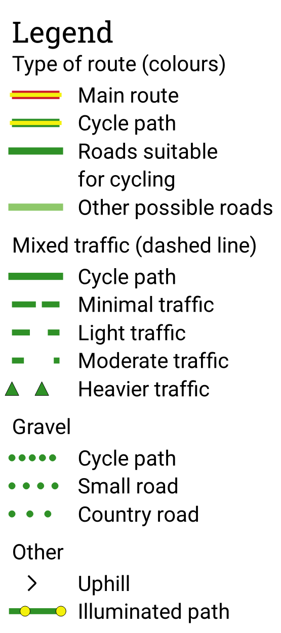
We have used colours as well as lines, solid or dashed, to illustrate the condition of a road for you as a cyclist. A solid line means a cycle path, a dashed line (green or red) means you cycle in mixed traffic. Roads marked with shorter dashes and longer gaps have more traffic but are generally still suitable for cycling.
On roads with light traffic, two adults can usually cycle together and chat (though all roads have more traffic during commuting hours). Even quieter cycling is found on roads with minimal traffic, where it is often safe to bring children on the ride.
A filled triangle indicates that a particular road has quite a bit of traffic but may be necessary to use for a short distance to avoid large detours. Gravel roads are marked with dots and typically have little traffic. Very hilly roads are marked with chevrons pointing in the direction of the uphill slopes. Illuminated paths are only shown outside urban areas.
The colours indicate how a cycle path is used. Yellow with a red border means a main route, which is a fast route between larger towns, primarily on cycle paths. A thicker line indicates a more prominent route. Yellow with a green border indicates a national or regional cycle route (numbered). Green is used for roads suitable for cycling, meaning cycle paths and low-traffic roads that together form a connected network. Light green indicates other possible roads, i.e. roads that can be cycled on but often end at a road with more traffic (on urban maps, it means other cycle paths).
Our cycle map plan (LNF cykelplan) shows possible connections between municipal centers in southern Sweden. Necessary expansions are shown in blue. Light blue on the road means a relatively inexpensive measure (e.g. asphalting a minor road), while dark blue shows roads where a new cycle path is required. (Enlarge the map to see more suggestions for expansions.)
The map is based on the National Road Database (nvdb) and maps from the Swedish Mapping, Cadastral and Land Registration Authority.
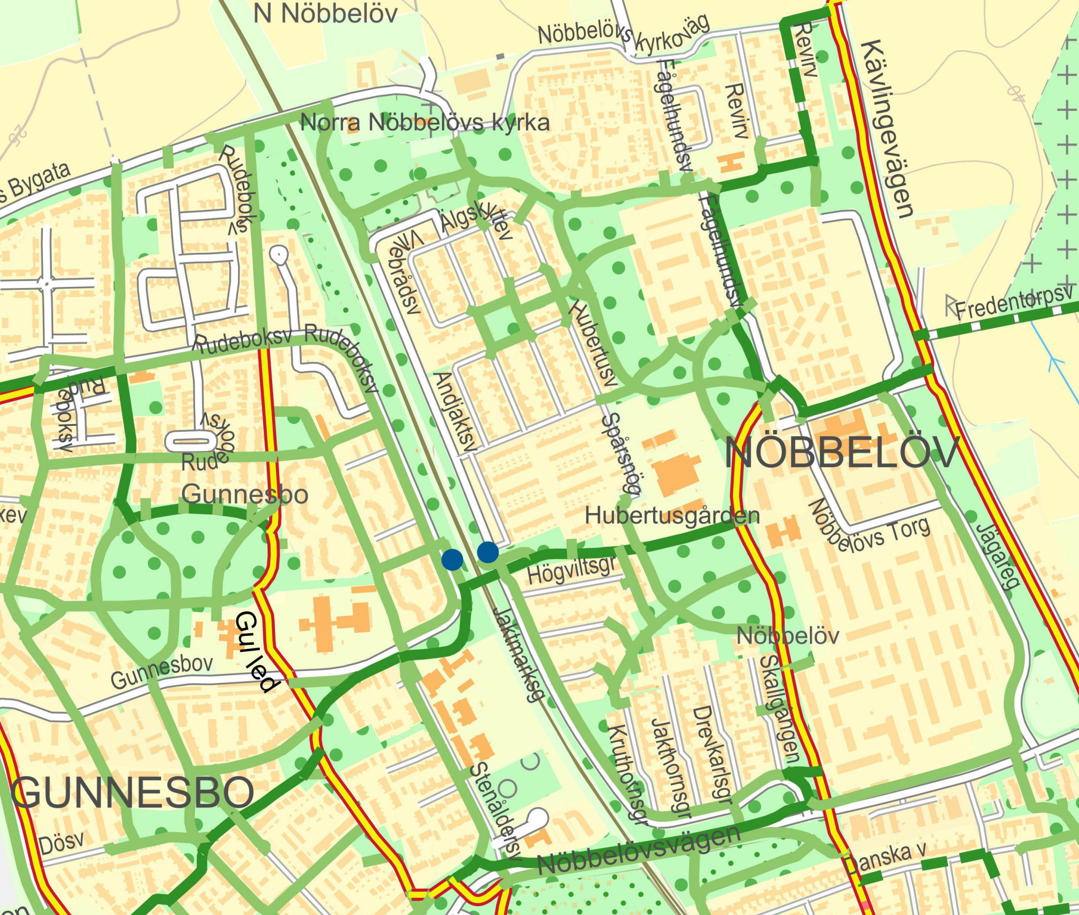
Example of a map image north of Lund. This shows both the main route from Stångby south towards Lund and the regional Skåne Cycle Route that passes through Svenstorp and Örtofta.
A map is never neutral. The image the reader gets can influence quite a lot of the route choices made. This is mainly about the roads that the map recommends as cycle routes. A map symbol that shows where you need to cycle on roads with car traffic, so-called mixed traffic, can be perceived in different ways. A low-traffic road like this can discourage people because they believe that car traffic is always dangerous, but it can also lull the cyclist into a false sense of security if the road has more traffic than expected. When the cycle map shows a warning triangle, the road may be fine for cycling on a weekend or in the middle of the day during the summer, but it may also be unsuitable for commuting as the traffic is too dense in relation to the width of the road.
Part of the urban area map of the city of Lund. There are many good bicycle connections and they almost always go on bicycle paths. Note that Lund’s coloured bicycle routes are marked with text instead of different colours